Situated in the country seat of Gyangtse, it is the place where the patriotic soldiers and civilians in Tibet fought heroically against the British invaders in the 30th year of the Guangxu reign period (1904) of the Qing Dynasty. The forts and ruins of the war on the hill can still be seen.
Transport: Chartering an automobile is a very common means of transportation and the most preferred choice for many tourists.
Admission (for reference): 30 Yuan/ person
Opening hours: 09:00- 18:00
An ancient earth/back castle, it is located to the northeast of Gamba County seat and was an important defensive point of the Gamba tribe.
Transport: it is about 400 km from Lhasa to Gamba, via Nanggarze and Kangmar.
Travel tips: Now the Gamba Castle is a frontier camp. Tourists should obtain permission for a visit in advance.
Atop the Rongpu Qinzhogma Hill at the foot of Mt. Qomolangma (Mount Everest in Tibet), the monastery is 90 kilometers away from the Tingri County seat and is 5,800 meters above sea level, the highest of its kind in the world. Annually it holds three-day sorcerers activities on the 15th of the fourth month and the Ghost- Beating Festival on the 29th of the 11th month of the Tibetan calendar.
Transport: It is about 60 km from New Tingri to the Rongpu Monastery. Tourists may take a taxi to go to the monastery because there are no regular buses.
Admission (for reference): 5 Yuan/person
Opening hours: 09:00-17:00 (the halls are closed from 12:00- 14:00)
Accommodation: Tourists may put up for the night at the monastery, 25 Yuan per bed; and camping on the lawn costs 10 Yuan a tent.
The fifth highest peak in the world, the Makaru Mountain is 8,463 meters above sea level and its straight distance to Mt.Qomulangma is 24 kilometers. Its northern slope is in china while the southern slop in Nepal. The mountain has five ridges. The Weifeng peak on the southeast ridge is the highest, being 8,010 meters above sea level. In the valleys and slopes are glaciers. Snow slides or ice-falls always happen in the cracks of the saw-shaped cliffs.
The recommended itinerary: The coverage from New Tingri to Yupar Town via Parco is 120 kilometers. Going southward along the Ganma Zangbo Valley you need to take a yak from Yupar to Shajitang mountaineering camp on the northeast foot of Makaru Mountain with an elevation of 3,600 meters. The extensive camp has enough water sources.
A boundary mountain range of Nyalam and Tingri counties, there are three peaks of an elevation of more than 7,000 meters from the east to the west and the highest is 7,367 meters above sea level. Around these peaks are icy mountain slopes and forest of icy pagodas. The wonderful scene is that there are many glacier lakes around them, with the bigger one of the Lake Colangma on the northern foot.
It is not easy to climb up these peaks. The frequent snow slides, ice-falls, and stone slides on the icy slopes bring a lot of difficulties to the mountaineering. In 1987, the Sino-Japanese joint mountaineering team was first successful in the climb up these peaks.
In Nyalam County, the lake Paiku Tso is the largest of its kind in Xigaze prefecture and covers an area of more than 300 square kilometers. In the breast of three mountains, the lake is rich in fish resources. Its neighboring areas are inhabited by wildlife such as wild horses, wild donkeys, and yellow ducks.
The fourth highest mountain in the world, the 8,516- meter-high Lhoze Mountain is three kilometers to the south of Mt. Qomolangma. In Tibetan, Luoze means a green beautiful fairy maiden.
But this “fairy maiden “has precipitous steep and a changeable climate. From early June to mid-September, it has many snow slides and storms. In the winter the temperature will be -60 degree C.
In 1956, the Swiss mountaineering team was the first to climb up successfully the mountain from the western slope in Nepal. The mountaineering from the eastern slope in china is more difficult and there is no successful mountaineering record from the eastern slope.
The recommended itinerary: It takes 110 kilometers from New Tingri to the northern foot of Mt.Qumolangma via Parco.
The Kanggardo Mountain in Cona County is 7,060 meters above sea level.
Covered by snow year-round, the topography is lower in the southern section and higher in the northern section. Its main peak is surrounded by dozens of peaks with an elevation of more than 6,000 meters. In its valley are many glaciers. The annual rainfall is more than 400 mm. From June to September is the rain season. On the mountain slopes and gullies are dense forests teeming with dozens of kinds of wildlife such as the wild donkeys and Mongolian gazelles.
In Nagarze County in Lhoka Prefecture, the lake is 4,400 meters above sea level. It covers an area of 800 square kilometers and is 30-40 meters deep. Yamzho means upper pasture and Yum means green jade in Tibetan. In a bird’s- eye view, the lake is like a big piece of sapphire inlaid in the mountains and is very beautiful.
The lake is rich in hydropower resources. Its surface is more than 800 meters higher than the Yarlung Zangbo River at the foot of the mountain. Also here stands the Yamzho Yumco Power Station well known for its high elevation in the world. To its south stands the magnificent Samding Monastery where Dorje Pamo, the only women Living Buddha in Tibet, stayed and presided.
Transport: Tourists may take the regular bus from Lhasa to Nanggarze, or take a taxi.
Accommodation: The Cereal Hostel is in the county seat of Nanggarze, 20 to 30 Yuan a bed.
Located at the lower reaches of Yarlung Zangbo River and an elevation of 3,000 meters, Nyingchi has a moist climate and beautiful scenery. It is a region where Menba and Luoba minorities live in a compact community with unique folk customs. Namjagbarwa peak, the unrivaled Yarlung Zangbo River canyon, Lake Pagsum Co, Zayu Nature Reserve, and Bomi unique landscape have attracted lots of overseas and domestic tourists.
Also known as the Lake Conggo, it is a national scenic zone in the Xoka District in Gongbogyamda County with an elevation of more than 4,000 meters. It is more than 300 kilometers away from Lhasa. In the middle of the lake, there is an ancient temple of the Rnyingma Sect built in the 17th century. During the walking Around the Lake Festival on the 15th of the fourth month of the Tibetan calendar, Buddhist believers from Nyingchi and other places come to walk around the lake.
Holiday resort by the Lake Pagsum Co is the first of its kind in Tibet and is in individual-and vill-typed architectural style.
Transport: tourists may charter a car at Bayi Town or Gongbogyamda in Nyingchi to get there.
Admission (for reference): 50 Yuan/ person, an additional charge of 300 Yuan/per boat for the boat trip on the lake.
Situated in Pagqi Township, Nyingchi County, the nature reserve grows several hundred cypresses of more than 1,000 years old. The pagoda-shaped tree crowns and trunks are very attractive and eye-catching. These huge cypresses are peculiar to Tibet, which are also called the Yarlung Zangbo cypresses. With an average height of 44 m, the huge cypresses have a diameter of 158 cm on average. Of them, a huge cypress is so large that it is difficult for over 10 people with outstretched arms to circle it. It is over 50 m high, with a diameter of nearly six m; and an area of over one mu (one mu =1/15 hectare). According to calculation, the huge cypress is 2,000-2,500 years old, which is regarded as a sacred tree by the local people and is under good protection. The ancient cypress forest is the holy land in the eyes of the local Tibetan people. Legend has it that the life tree of Xinrab Mipao, founder of Bon Sect, is the ancient cypress. Hence the largest and oldest trees in the forest are covered with wind-horse flags, and Mani piles can be seen everywhere in the forest. Every year many pilgrims come here to pay homage to the ancient cypresses.
Transport: Tourists may get on a minibus at Bayi Town to the county seat of Nyingchi, or go to the forest by taxi.
Admission (for reference): 10 Yuan/ person
Situated in Bomi County, Nyingchi Prefecture, Tibet, the Yi’ong National Geological Park is at the summit of the Yarlung Zangbo Grand Canyon, with an area of 2,160.8 sq km, and an average elevation of about 4,000 m. with dense primitive forests, the Yi’ong National Geological park is an “ecological source” with biological diversity and the source of many rivers. It is a comprehensive geological museum integrating the ruins of the high-speed landslide geological disasters, the largest marine glacier in china, clusters of snow-covered mountains, dammed lakes, ice lakes, canyons, waterfalls, mud-rock flow gullies, horn peaks, iron hills, and hot springs.
Situated in the Qinghai- Tibet Plateau, known as the “roof of the world,” the Yarlung Zangbo River Canyon undulated 496.3 km long, with an average elevation of over 3,000 m, and the down-cutting erosion reaches 5,382 m. it is longer than the Colorado Canyon (440 km long) in the United States, the longest canyon in the world; and deeper than the Colca Canyon (3,200 m deep) in Peru, the deepest canyon in the world. The Yarlung River Canyon contains nine vertical natural zones, ranging from the alpine ice and snow zone to the tropical rain forests, so it is the place with the most complete alpine vertical natural zones in the world.
Transport: tourists may get on a bus at Bayi Town, Nyingchi, and get off at Pelung. Tourists need to walk from Pelung to Zhaqu to appreciate the Yarlung Zangbo River Canyon.
Travel trip: it takes about one month to go through the canyon, and tourists are only allowed to enter the canyon from July to October every year.
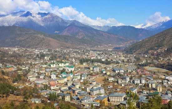
One of the most highly sought-after tourist destinations in the Himalayas, Bhutan…
If you've ever daydreamed of misty mountain mornings, prayer-flag-riddled ridges, and the…
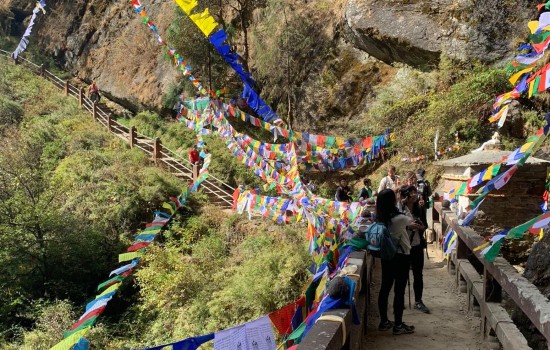
Planning a trek in Bhutan? Learn how to choose the best routes…
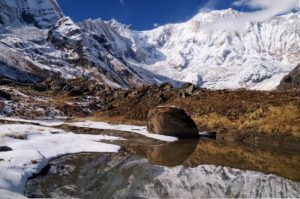
As you trek up to the Annapurna Base Camp, you will most…
Nepal is a perfect place to stay as it boasts some of…
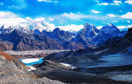
Gokyo Ri View When is the best time to hike to Everest…
